 Lýsigagnagátt
Uppréttar sögulegar loftmyndir frá 1974 - 2000 / Historical aerial image orthomosaics from 1974 - 2000
IS:
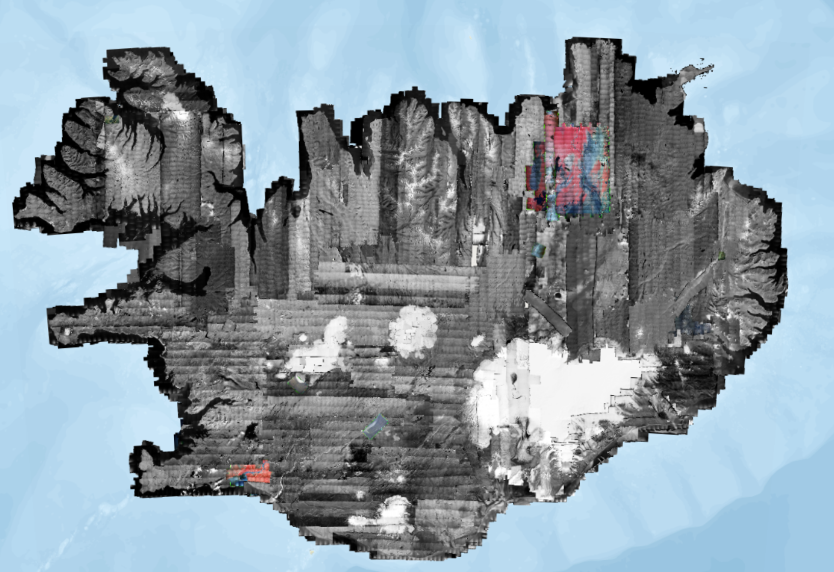
Samsettar og uppréttar sögulegar loftmyndir af Íslandi. Unnið er að því að staðsetja loftmyndir frá 1974 – 2000 úr loftmyndasafni Náttúrufræðistofnunar ( https://gatt.lmi.is/geonetwork/srv/ice/catalog.search#/metadata/d2323e18-ab9f-495d-8a4e-58c2a5fb096e ). Myndirnar eru birtar jafnóðum og búið er að staðsetja þær en ætlunin er að staðsetja eldri myndir síðar. Svæði af myndum sem teknar voru í sama flugi og úr sömu flughæð eru sett saman. Upplausn myndanna er yfirleitt 50 cm.
Búið er að vinna myndirnar með sjálfvirkum aðferðum. Ákveðnar staðsetningar eru valdar af gervitunglamyndum ( https://gatt.lmi.is/geonetwork/srv/ice/catalog.search#/metadata/e542c260-6431-48a5-8065-93350b8cb3a1) og stilltar af á ÍslandsDEM landhæðalíkaninu ( https://gatt.lmi.is/geonetwork/srv/ice/catalog.search#/metadata/e6712430-a63c-4ae5-9158-c89d16da6361 ). Áætluð staðsetningarnákvæmni myndanna er minna en 2 m.
Heimild:
Náttúrufræðistofnun. Uppréttar sögulegar loftmyndir frá 1974 - 2000. Dagsetning myndar. loftmyndasja.gis.is. [Loftmynd].
EN:
This repository includes orthorectified and mosaicked historical aerial images from all over Iceland. The datasets are created from historical aerial images on film from the years 1974 - 2000 from the aerial photograph collection of the NLSI ( https://gatt.lmi.is/geonetwork/srv/ice/catalog.search#/metadata/d2323e18-ab9f-495d-8a4e-58c2a5fb096e). Each mosaic is created from images taken on the same day at approximately the same height. The resolution of the mosaics is usually 50 cm.
The historical photographs have been processed using automated methods of detection of points of interest using the Maxar mosaic ( https://gatt.lmi.is/geonetwork/srv/ice/catalog.search#/metadata/e542c260-6431-48a5-8065-93350b8cb3a1)) followed by a refined correction of the cameras using the IslandsDEM ( https://gatt.lmi.is/geonetwork/srv/ice/catalog.search#/metadata/e6712430-a63c-4ae5-9158-c89d16da6361) as reference. The estimated horizontal accuracy of the orthorectified aerial imagery is better than 2 meters.
Citation:
Natural Science Institute of Iceland [Náttúrufræðistofnun]. Historical aerial image orthomosaics from 1974 - 2000 [Uppréttar sögulegar loftmyndir frá 1974 - 2000]. Imagery date. loftmyndasja.gis.is. [Aerial Imagery].
Simple
- Date (Publication)
- 2022-11-25T10:25:00
- Edition
-
2.0
- Status
- On going
- Point of contact
-
Organisation name Individual name Electronic mail address Role Náttúrufræðistofnun
Þjónustufulltrúi
Originator
- Maintenance and update frequency
- Continual
- Theme
-
-
loftmyndasafn
-
loftmyndir
-
aerial photographs
-
orthorectified
-
open data
-
GSL
-
- Place
-
-
World
-
- Access constraints
- Other restrictions
- Other constraints
- no limitations to public access
- Use constraints
- Other restrictions
- Other constraints
- Attribution 4.0 International (CC BY 4.0)
- Denominator
- 36000
- Language
-
ice
- Character set
- UTF8
- Topic category
-
- Imagery base maps earth cover
- Begin date
- 1937-07-01
- End date
- 2000-09-09
))
- Reference system identifier
- EPSG:3057 (ISN93)
- Number of dimensions
- 2
- Dimension name
- Row
- Dimension name
- Column
- Dimension size
- 1
- Dimension name
- Vertical
- Dimension size
- 1
- Resolution
- 50 cm
- Cell geometry
- Area
Digital transfer options
- OnLine resource
-
Protocol Linkage Name OGC:WMS
https://gis.lmi.is/mapcache/loftmyndasafn/isn93/wms?service=wms&request=getcapabilities WWW:LINK-1.0-http--link
http://www.lmi.is/ Heimasíða Náttúrufræðistofnun
WWW:LINK-1.0-http--link
https://loftmyndasja.lmi.is/mapview/?application=loftmyndasja Loftmyndasjá
- Hierarchy level
- Dataset
- Statement
-
1. útgáfa myndir frá 1994 - 2000. 2. útgáfa myndir frá 1974 - 2000.
Metadata
- File identifier
- 4fd787a1-5f3f-43ab-8d23-280ecbe6a3fb XML
- Metadata language
- English
- Character set
- UTF8
- Parent identifier
-
Loftmyndasafn LMÍ
d2323e18-ab9f-495d-8a4e-58c2a5fb096e
- Date stamp
- 2026-01-19T11:26:42
- Metadata standard name
-
ISO 19115:2003/19139
- Metadata standard version
-
2.0
- Metadata author
-
Organisation name Individual name Electronic mail address Role Náttúrufræðistofnun
Svið Landmælinga og Landupplýsinga
Point of contact
)))