 Lýsigagnagátt
ni_j100v Strik og Halli á Austurlandi – 1:100.000
Þekja (layer) j100v_austurland_strikHalli_1utg_p:
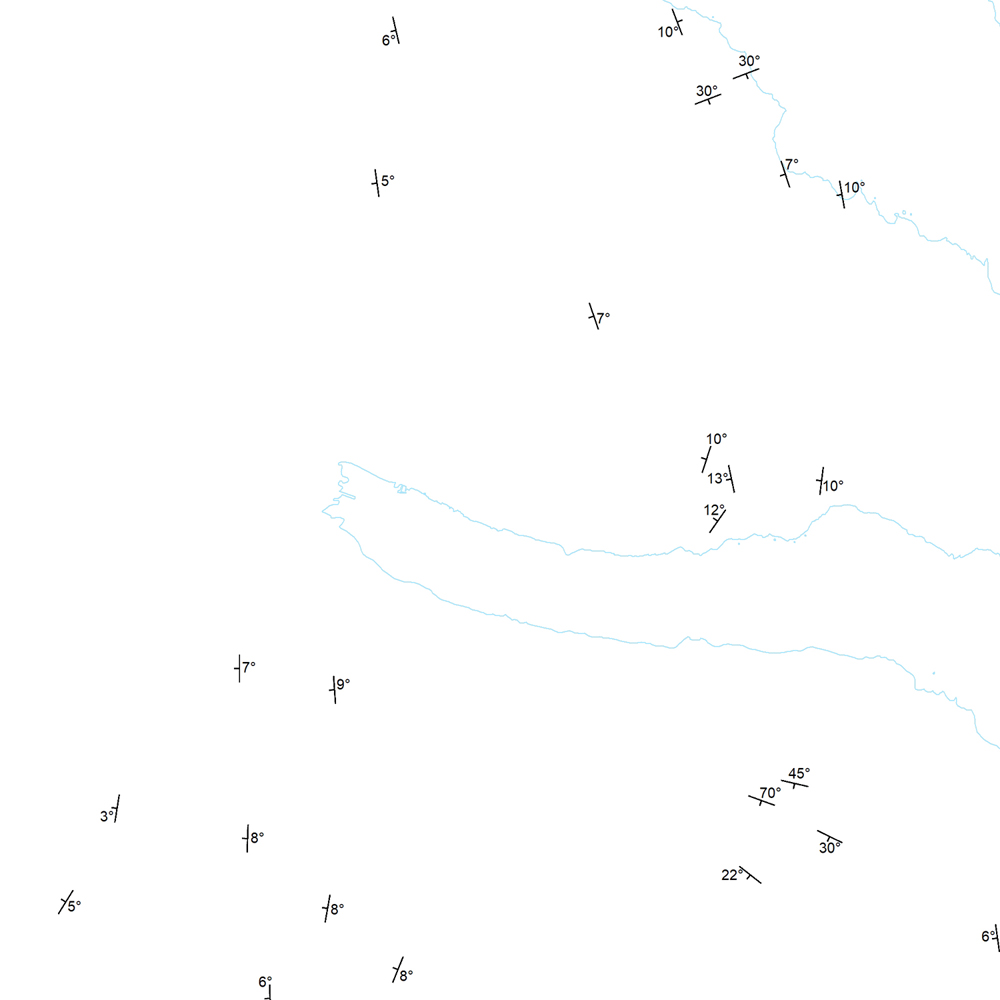
Strik og hallastefna jarðlaga. [Strike and dip of the deposits.]
Staðsetning mælinga á striki og hallastefnu jarðlaga á Austurlandi.
[Locations of measurements of strike and dip of the deposits in Eastern Iceland.]
Simple
- Date (Publication)
- 2019-12-31
- Edition
-
1. útg.
- Other citation details
-
Tilvísun: Birgir V. Óskarsson og Martin J. Riishuus 2019. Jarðfræðikort af Austurlandi. 1:100.000. 1. útg. Garðabær: Náttúrufræðistofnun Íslands. Bibliograðhic reference: Óskarsson, B.V. and Riishuus, M.S. 2019. Geological Map of Eastern Iceland. 1:100.000. 1st edition. Garðabær: Icelandic Institute of Natural History.
- Collective title
-
Jarðfræðikort af Austurlandi 1. útg. – 1:100.000 – NI_J100v_Austurland_1.utg
- Status
- On going
- Point of contact
-
Organisation name Individual name Electronic mail address Role Náttúrufræðistofnun – Natural Science Institute of Iceland
Originator
- Maintenance and update frequency
- As needed
- Theme
-
-
GSL
-
- Place
-
-
National
-
-
GEMET - INSPIRE themes, version 1.0
-
-
Geology
-
- Access constraints
- Copyright
- Use constraints
- Copyright
- Other constraints
-
https://www.natt.is/is/midlun/opin-gogn
Gögnin eru öllum opin – no limitations on public access
- Spatial representation type
- Vector
- Denominator
- 100000
- Language
- ice
- Character set
- UTF8
- Topic category
-
- Geoscientific information
))
- Begin date
- 2019-06-30
- End date
- 2019-12-31
- Reference system identifier
- EPSG / 3057
- Distribution format
-
Name Version ESRI ArcGIS FileGDB
10.2.0.3389
ESRI Shapefile
10.2.0.3389
Digital transfer options
- OnLine resource
-
Protocol Linkage Name WWW:LINK-1.0-http--link
https://www.natt.is/is/midlun/opin-gogn/nidurhal-gagna Niðurhal gagna
WWW:LINK-1.0-http--link
https://jardfraedikort.ni.is/ NÁTT kortasjá 'Jarðfræði Íslands'
WWW:LINK-1.0-http--link
https://www.natt.is Vefur Náttúrufræðistofnunar
WWW:LINK-1.0-http--link
https://www.breiddalssetur.is/index.php/is/walker Feltgögn og kort eftir breska jarðfræðinginn George P. L. Walker
WWW:LINK-1.0-http--link
https://www.natt.is/is/midlun/grunngerd-landupplysinga/gagnalysingar-og-fitjuskrar Íslenskt fitjuskrá '600 Jarðmyndun og landmótun' sem tengjast staðlinum ÍST 120 (PDF)
WWW:LINK-1.0-http--link
https://www.natt.is/is/midlun/opin-gogn Skilmálar (PDF) – Licence (PDF)
OGC:WMS
https://gis.natt.is/geoserver/wfs?request=GetCapabilities ni:ni_j100v_austurland_strik_halli_1utg_p
- Hierarchy level
- Dataset
- Statement
-
Birgir V. Óskarsson jarðfræðingur vann að kortlagningu svæðisins og tengingu eldri korta. Gögn eru einnig fengin úr eftirfarandi heimildum:
[Birgir V. Óskarsson geologist mapped in the field and compiled the Geological Map of Eastern Iceland from older maps. Data is also based on references below:].
Gibson, I.; Kinsman, D. and Walker, G., 1966, Geology of the Fáskrúðsfjörður area, Eastern Iceland, Visindafelag Íslendinga, Greinar IV,2, 52.
Walker, G. P. L. 1974, The structure of eastern Iceland, Geodynamics of Iceland and the North Atlantic Area, 177-188.
Walker, G. P. L., 1960, Unpublished compilation 1:100 000, Available at Breiðdalssetur in Breiðdalsvík, 1960.
Walker, G. P. L., 1963, The Breiddalur central volcano, eastern Iceland, Quarterly Journal of the Geological Society, 119, 29-63.
Metadata
- File identifier
- b012331b-be66-4108-a1b3-a1d7d9e4c959 XML
- Metadata language
- English
- Character set
- UTF8
- Parent identifier
-
Jarðfræðikort af Austurlandi 1. útgáfa – 1:100.000
c907fbd3-7420-4c0b-81e4-b877514ba8c5
- Date stamp
- 2025-08-08T12:22:35
- Metadata standard name
-
INSPIRE Metadata Implementing Rules
- Metadata standard version
-
Technical Guidelines based on EN ISO 19115 and EN ISO 19119 (Version 1.2)
- Metadata author
-
Organisation name Individual name Electronic mail address Role Náttúrufræðistofnun – Natural Science Institute of Iceland
Point of contact
)))