 Lýsigagnagátt
Grunnkort NIR Loftmynd NÁTT -- NIR Basemap NÁTT
IS:
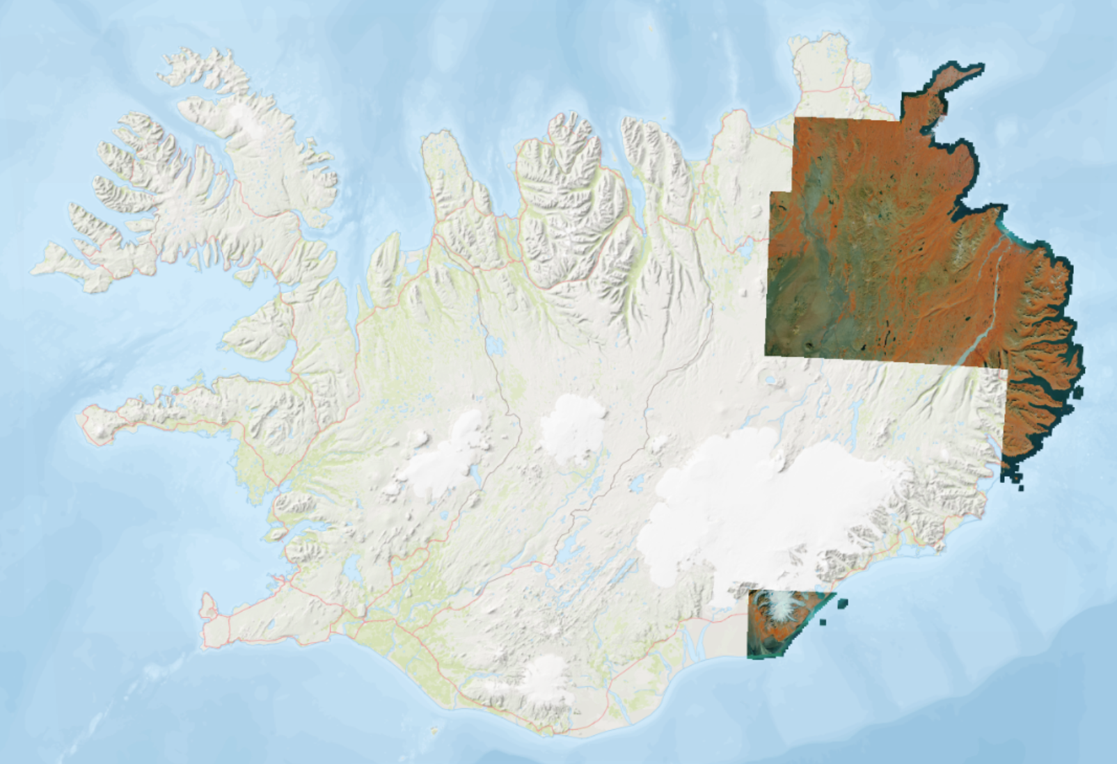
Innrautt grunnkort byggt á nær innrauðum loftmyndum í 25 x 25 cm upplausn. Áætluð nákvæmni er 50 cm eða betri. Grunnkortið sýnir ekki allt landið eins og staðan er núna en markmiðið er landsþekjandi grunnkort. Gögnin eru uppfærð einu sinni á ári eða oftar og eftir því sem nýjar loftmyndir berast.
Heimild:
Náttúrufræðistofnun, 2025. Grunnkort -- NIR Loftmynd. Dagsetning myndar. Kort.gis.is. [Loftmynd].
EN:
False-color near infrared aerial imagery mosaic in 25 x 25 cm resolution. The expected positional accuracy is 50 cm or better. The base map does not show the entire country as it currently stands, but the goal is to have a nationwide base map. The data is updated once a year or more often and as new aerial imagery is received.
Please cite as:
Náttúrufræðistofnun [Natural Science Institute of Iceland], 2025. Grunnkort -- NIR Loftmynd [Basemap -- Aerial Imagery]. Image date. Kort.gis.is. [Imagery].
Simple
- Date (Creation)
- 2026-01-07
- Status
- On going
- Point of contact
-
Organisation name Individual name Electronic mail address Role Náttúrufræðistofnun
Svið Landmælinga og Landupplýsinga
Custodian
- Maintenance and update frequency
- Annually
- Keywords
-
-
loftmynd
-
innrauð loftmynd
-
GSL
-
opin gögn
-
aerial imagery
-
infrared
-
NSDI
-
open data
-
Iceland
-
- Access constraints
- Other restrictions
- Other constraints
- no limitations to public access
- Use constraints
- Copyright
- Other constraints
- Attribution 4.0 International (CC BY 4.0)
- Denominator
- 25
- Language
- English
- Character set
- UTF8
- Topic category
-
- Imagery base maps earth cover
))
- Reference system identifier
- EPSG:8088 (ISN2016)
- Distribution format
-
Name Version GeoTIFF
1.0
WMS
Digital transfer options
- OnLine resource
-
Protocol Linkage Name WWW:LINK-1.0-http--link
http://www.natt.is/ Heimasíða Náttúrufræðistofnun
WWW:LINK-1.0-http--link
https://kort.gis.is/mapview/?app=kort&l=is&c=-2100000,9615900&z=2.0&ls=13790,14135,16143&op=14135_1,16143_1&eg=14527,13782 Kortagluggi
OGC:WMS
https://gis.natt.is/mapcache/isn93/wms grunnkort-NIR-loftmynd
OGC:WMS
https://gis.natt.is/mapcache/web-mercator/wms grunnkort-NIR-loftmynd
OGC:WMS
https://gis.natt.is/mapcache/isn2016/wms grunnkort-NIR-loftmynd
- Hierarchy level
- Dataset
- Statement
-
IS: Loftmyndirnar eru teknar árlega á milli júní og september.
EN: Aerial imagery in this mosaic is collected yearly between June - September.
Metadata
- File identifier
- b12556ac-0e46-4643-b560-7e5a803faa44 XML
- Metadata language
- ice
- Character set
- UTF8
- Date stamp
- 2026-01-28T10:07:53
- Metadata standard name
-
ISO 19115:2003/19139
- Metadata standard version
-
1.0
- Metadata author
-
Organisation name Individual name Electronic mail address Role Náttúrufræðistofnun
Svið Landmælinga og Landupplýsinga Náttúrufræðistofnunnar
Point of contact
)))