 Lýsigagnagátt
Stefnuskekkja
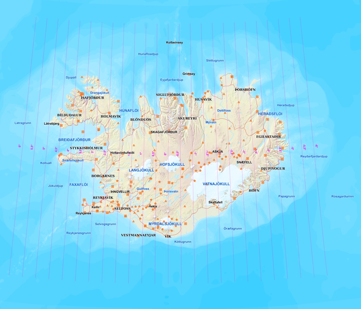
Þessi þekja sýnir stefnuskekkjur (Meridian Convergence) fyrir Lambert Conformal Conic kortavörpunina sem oftast er notuð fyrir ISN hnitakerfin, stundum kölluð ISNET vörpun. ISN93 EPSG:3057, ISN2004 EPSG:5325 og ISN2016 EPSG:8088.
Stefnuskekkjan segir okkur hvernig norðurstefna á korti víkur frá raunverulegri norðurstefnu á sporvölu GRS80. Þetta veldur því að fyrirbæri virðast norðar en þau í raun og veru eru út frá lengdarási vörpunarinnar sem er 19°vestur í okkar tilfelli. Því lengra sem við fjarlægjumst ásinn þeim mun meir bjögun fáum við.
Sem dæmi er norðurhnit Hraunhafnatanga um 270m hærra en norðurhnit Rifstanga í ISNET vörpun, en í raun er Rifstangi um 65m norðar þegar hnattstað hans er skoðuð í baughnitum á sporvölu GRS80. Hraunhafnatangi er um 7,4km austar en Rifstangi.
Simple
- Date (Publication)
- 2021-06-09
- Status
- Completed
- Point of contact
-
Organisation name Individual name Electronic mail address Role Náttúrufræðistofnun
Distributor Náttúrufræðistofnun
Guðmundur Valsson
Point of contact
- Maintenance and update frequency
- As needed
- Theme
-
-
Opin gögn LMÍ
-
Open data
-
Raster gögn LMÍ
-
GSL
-
- Place
-
-
Iceland
-
- Use limitation
- Spatial representation type
- Vector
- Denominator
- 50
- Language
- English
- Character set
- UTF8
- Topic category
-
- Geoscientific information
))
- Reference system identifier
- 3057
- Distribution format
-
Name Version GeoTIFF
1.0
KML
0
PNG
0
GML
3.2.1
ZIP
0
Digital transfer options
- OnLine resource
-
Protocol Linkage Name WWW:LINK-1.0-http--link
http://www.lmi.is/ Heimasíða Náttúrufræðistofnun
WWW:LINK-1.0-http--link
https://gis.lmi.is/geoserver/web/ Niðurhalssíða Náttúrufræðistofnun
WWW:LINK-1.0-http--link
https://atlas.lmi.is/mapview/?app=maelingasja&l=is&c=497037,495616&z=3.0&ls=729,730,544,774,727,552,551 Geodetic Map Viewer - Mælingasjá
OGC:WMS-1.3.0-http-get-capabilities
https://gis.lmi.is/geoserver/wms?request=GetCapabilities&service=WMS Grunnkerfi:lcc_mc
OGC:WFS-2.0.0-http-get-capabilities
https://gis.lmi.is/geoserver/wfs?request=GetCapabilities&service=WFS Grunnkerfi:lcc_mc
- Hierarchy level
- Dataset
- Statement
-
Vinsamlega hafið samband við Náttúrufræðistofnun vegnan nánari upplýsinga.
Metadata
- File identifier
- b7d2ab9e-0f2b-4266-b67b-aa09096c6d4b XML
- Metadata language
- ice
- Character set
- UTF8
- Date stamp
- 2026-09-29T13:45:29.74012652Z
- Metadata standard name
-
ISO 19115:2003/19139
- Metadata standard version
-
1.0
- Metadata author
-
Organisation name Individual name Electronic mail address Role Natural Science Institute of Iceland
Point of contact
)))