 Lýsigagnagátt
Grunnkort Loftmynd NÁTT -- Aerial Imagery Basemap NÁTT
IS:
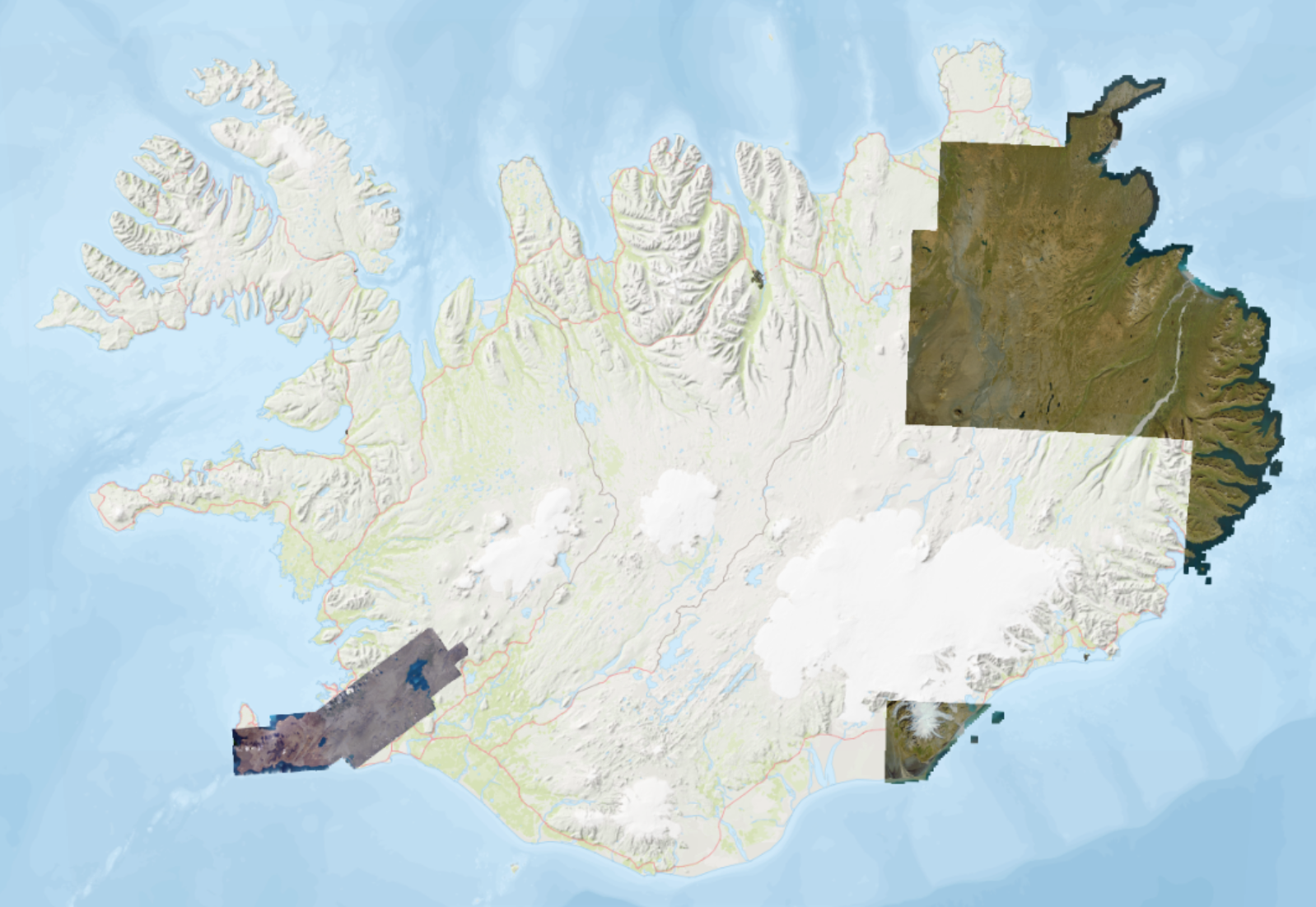
Grunnkort byggt á loftmyndum í 25 x 25 cm upplausn eða betri. Áætluð nákvæmni er 50 cm eða betri. Grunnkortið sýnir ekki allt landið eins og staðan er núna en markmiðið er landsþekjandi grunnkort. Gögnin eru uppfærð einu sinni á ári eða oftar og eftir því sem nýjar loftmyndir berast.
Heimild:
Náttúrufræðistofnun, 2025. Grunnkort -- Loftmynd. Dagsetning myndar. Kort.gis.is. [Loftmynd].
EN:
Country-wide aerial imagery mosaic in 25 x 25 cm resolution or better. The expected positional accuracy is 50 cm or better. The base map does not show the entire country as it currently stands, but the goal is to have a nationwide base map. The data is updated once a year or more often and as new aerial imagery is received.
Please cite as:
Náttúrufræðistofnun [Natural Science Institute of Iceland], 2025. Grunnkort -- Loftmynd [Basemap -- Aerial Imagery]. Image date. Kort.gis.is. [Imagery].
Simple
- Date (Creation)
- 2026-01-07
- Status
- On going
- Point of contact
-
Organisation name Individual name Electronic mail address Role Náttúrufræðistofnun
Svið Landmælinga og Landupplýsinga
Custodian
- Maintenance and update frequency
- Annually
- Theme
-
-
loftmynd
-
GSL
-
opin gögn
-
Ísland
-
aerial imagery
-
NSDI
-
open data
-
Iceland
-
- Access constraints
- Other restrictions
- Other constraints
- no limitations to public access
- Use constraints
- Copyright
- Other constraints
- Attribution 4.0 International (CC BY 4.0)
- Language
- English
- Character set
- UTF8
- Topic category
-
- Imagery base maps earth cover
))
- Reference system identifier
- EPSG:8088 (ISN2016)
- Distribution format
-
Name Version GeoTIFF
1.0
WMS
Digital transfer options
- OnLine resource
-
Protocol Linkage Name WWW:LINK-1.0-http--link
http://www.natt.is/ Heimasíða Náttúrufræðistofnun
WWW:LINK-1.0-http--link
https://kort.gis.is/mapview/?app=kort&l=is&c=-2100000,9615900&z=2.0&ls=13790,14135,16142&op=14135_1,16142_1&eg=14527,13782 Kortagluggi
OGC:WMS
https://gis.natt.is/mapcache/isn93/wms grunnkort-loftmynd
OGC:WMS
https://gis.natt.is/mapcache/web-mercator/wms grunnkort-loftmynd
OGC:WMS
https://gis.natt.is/mapcache/isn2016/wms grunnkort-loftmynd
OGC:WMS
https://gis.natt.is/geoserver/wms grunnkort_loftmynd_nidurhal
OGC:WMTS
https://gis.natt.is/mapcache/isn2016/wmts?service=wmts&request=getcapabilities WMTS dæmi
WWW:LINK-1.0-http--link
https://utgafa.natt.is/skyrslur/2026/NATT-26002.pdf Gæðaskýrsla um samsett myndkort af Íslandi: sumarið 2025
WWW:LINK-1.0-http--link
https://www.natt.is/is/midlun/opin-gogn Um opin gögn NÁTT -- About open data
- Hierarchy level
- Dataset
- Statement
-
IS: Loftmyndirnar eru teknar árlega á milli júní og september.
EN: Aerial imagery in this mosaic is collected yearly between June - September.
Metadata
- File identifier
- bd0e7245-2f62-4b2a-82c3-3e6e10b7f9ee XML
- Metadata language
- ice
- Character set
- UTF8
- Date stamp
- 2026-05-12T10:22:43
- Metadata standard name
-
ISO 19115:2003/19139
- Metadata standard version
-
1.0
- Metadata author
-
Organisation name Individual name Electronic mail address Role Náttúrufræðistofnun
Svið Landmælinga og Landupplýsinga Náttúrufræðistofnunnar
Point of contact
)))