 Lýsigagnagátt
Landgræðslugirðingar
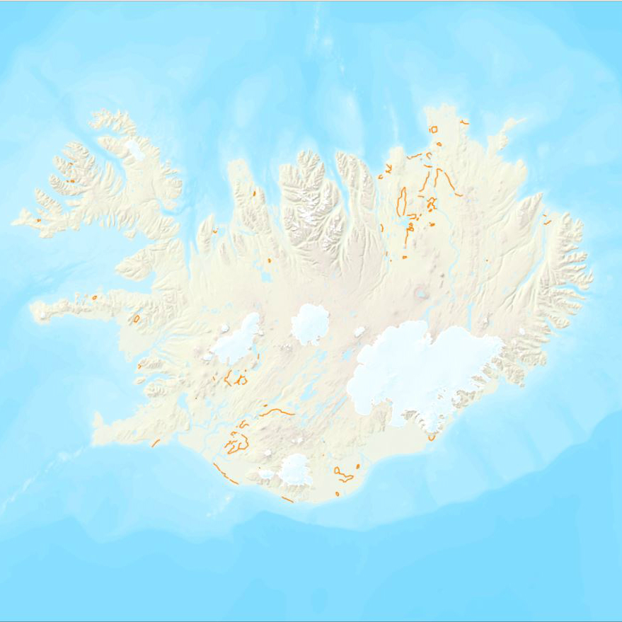
Gagnasett sem sýnir yfirlitsupplýsingar um landgræðslugirðingar sem Land og skógur á og/eða hefur umsjón með.
Simple
- Date (Publication)
- 2017-11-01
- Status
- On going
- Point of contact
-
Organisation name Individual name Electronic mail address Role Land og skógur
Point of contact
- Maintenance and update frequency
- As needed
- Theme
-
-
landgræðslugirðingar
-
GSL
-
- Theme
-
-
Girðingar
-
- Access constraints
- Other restrictions
- Other constraints
-
Stofnunin afhendir gögnin án gjalds. Geta þarf heimilda.
- Spatial representation type
- Vector
- Denominator
- 10000
Spatial resolution
Spatial resolution
- Language
- ice
- Character set
- UTF8
- Topic category
-
- Environment
))
- Supplemental Information
-
Athugið að hægt er að eyða út þeim reitum sem nýtast ekki í skráningunni með því að smella á rauða "x" merkið hjá reitunum. Einnig er hægt að bæta við reitum með því að smella á svarta "+" merkið. Hvoru tveggja getur hins vegar orðið til þess að lýsigögnin komist ekki í gegnum "validate" ferlið (hnappur á stikunni efst).
You can customize the template to suit your needs. You can add and remove fields and fill out default information e.g. contact details). Fields you can not change in the default view may be accessible in the more comprehensive (and more complex) advanced view. You can even use the XML editor to create custom structures, but they have to be validated by the system, so know what you do :-)
- Reference system identifier
- 3057
- Distribution format
-
Name Version ESRI Shapefile
1.0
Digital transfer options
- OnLine resource
-
Protocol Linkage Name WWW:LINK-1.0-http--link
https://island.is/s/land-og-skogur Land og skógur, heimasíða
WWW:LINK-1.0-http--link
https://kort.lmi.is/ Landupplýsingagátt
- Hierarchy level
- Dataset
- Statement
-
Gagnasett sem sýnir yfirlitsupplýsingar um landgræðslugirðingar sem Land og skógur á og/eða hefur umsjón með. Upplýsingarnar eru úr landupplýsingagrunni stofnunarinnar. Girðingarnar eru staðsettar með gps mælingum og m.a. skráð gerð þeirra, ástand og aldur.
Metadata
- File identifier
- ffedb375-2dc7-4027-88df-a94638fc4810 XML
- Metadata language
- ice
- Hierarchy level
- Dataset
- Date stamp
- 2026-04-20T14:09:34
- Metadata standard name
-
ISO 19115:2003/19139
- Metadata standard version
-
1.0
- Metadata author
-
Organisation name Individual name Electronic mail address Role Land og skógur
Point of contact
)))